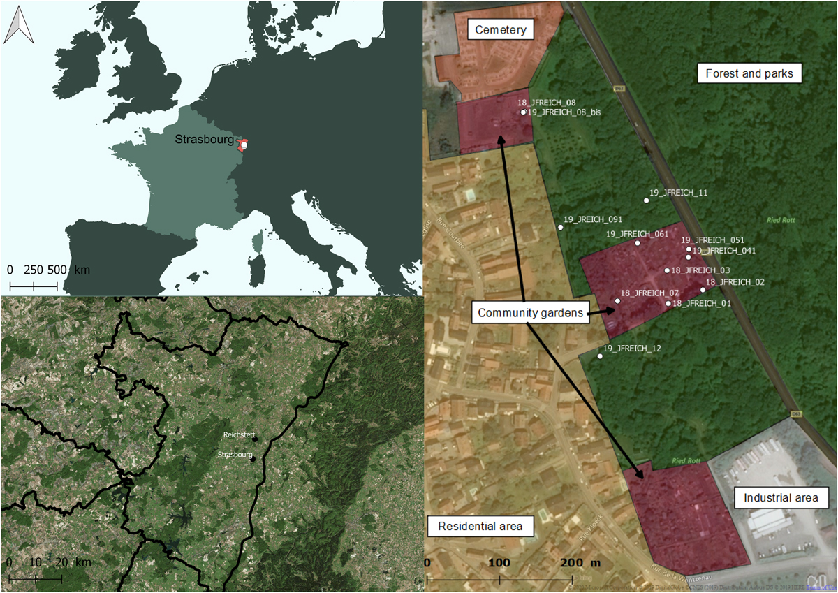
Figure 1

Download original image
Field area of interest in Reichstett, France. Relative locations of Strasbourg and Reichstett in the Bas-Rhin Department (in red). On the right, details on land uses of the studied area and ovitraps position are given. Industrial areas (grey) are mainly made of concrete with no or few breeding sites. Residential areas (yellow) represent the main land use with individual houses and private gardens. The Reichstett cemetery (orange) is located on the north border of the city and provides flower pots and saucers or other small containers which serve as breeding sites. Three community gardens (red–violet) are inside the field area of interest. Patches with garden sheds and water storage are delimited by low height fences. Parks with planted trees or smaller natural forest areas (green) separate community gardens. A larger natural forest is located beyond the departmental road. Street map background is under ©OpenStreetMap & contributors.
Current usage metrics show cumulative count of Article Views (full-text article views including HTML views, PDF and ePub downloads, according to the available data) and Abstracts Views on Vision4Press platform.
Data correspond to usage on the plateform after 2015. The current usage metrics is available 48-96 hours after online publication and is updated daily on week days.
Initial download of the metrics may take a while.


