Carte 1.
Download original image
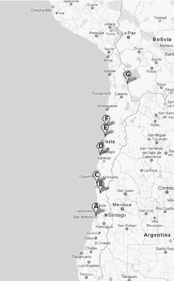
Répartition de Tunga bonneti, toutes les stations actuellement connues sont au Chili. A. Dunas de las Cruces (Santiago), 33° 29’ 50’’ S – 71° 37’ 22’’ O, altitude voisine de 0 m ; B. Reserva Nacional Las Chinchillas (Choapa), 31° 30’ 34’’S – 71° 06’ 23’’ O, 546 m ; C. Parque Nacional Bosques de Fray Jorge (Limari), 30° 38’ 25’’ S – 71° 31’ 09’’ O, 254 m ; D. Parque Nacional Llanos de Challe (Huasco), 28° 02’ 36’’ S – 71° 06’ 52’’ O, 104 m ; E. Parque Nacional Pan de Azúcar (Chañaral), 26° 09’ 35’’ S – 70° 40’ 01’’ O, 30 m ; F. Tal-Tal (Antofagasta), 25° 24’ 20’’ S – 70° 30’ 24’’ O, 25 m ; G. Quebrada del Inca (El Loa), près d’Ollagüe, 21° 10’ 03’’ S – 68° 19’ 54’’ O, 3 794 m. Cartographie Googlemaps 2011.
Current usage metrics show cumulative count of Article Views (full-text article views including HTML views, PDF and ePub downloads, according to the available data) and Abstracts Views on Vision4Press platform.
Data correspond to usage on the plateform after 2015. The current usage metrics is available 48-96 hours after online publication and is updated daily on week days.
Initial download of the metrics may take a while.